
UAV-LiDAR Surveying: Why It's Outperforming Traditional Methods
Key Points:
UAV-LiDAR surveying combines drone technology and laser scanning to produce highly accurate 3D terrain and spatial data.
Aerial drone survey services can significantly improve project speed, safety, and data collection efficiency compared to traditional surveying methods.
Aerial lidar survey technology is especially effective for large-scale sites, dense vegetation, hazardous terrain, and high-detail topographic mapping.
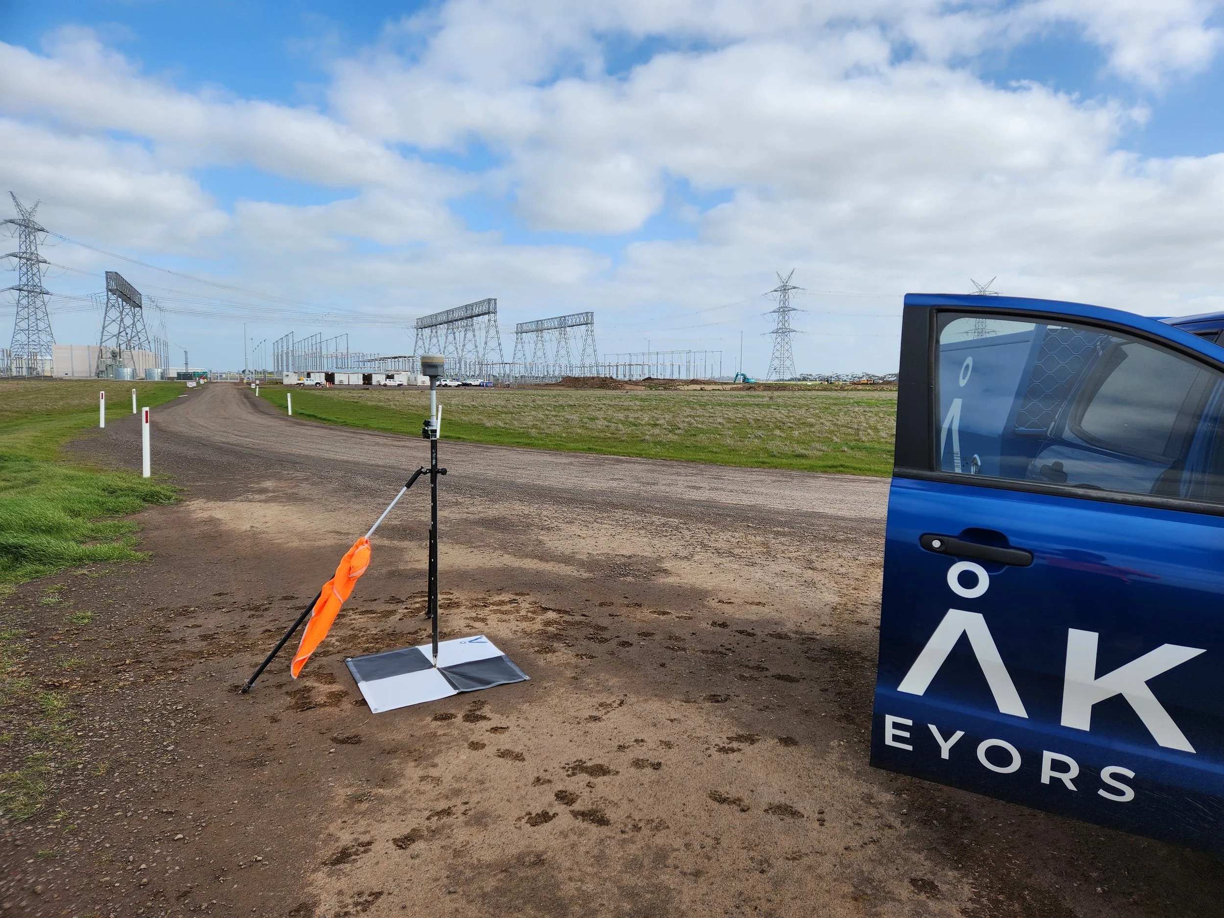
Peak Surveyors provides reliable lidar drone surveying and aerial drone surveying services tailored to modern project requirements.
Summary:
UAV-LiDAR surveying is helping modern projects capture accurate site data faster, safer, and more efficiently than many traditional survey methods. Using advanced aerial drone surveying technology, surveyors can map large sites, dense vegetation, and difficult terrain with exceptional detail and precision. Peak Surveyors delivers professional aerial lidar survey services and lidar drone surveying solutions across regional NSW and Victoria to support construction, infrastructure, environmental, and development projects.
Outline:
Surveying technology has advanced rapidly in recent years, and one of the biggest developments has been the rise of UAV-LiDAR surveying. By combining drone technology with advanced laser scanning systems, surveyors can now capture highly accurate site data faster, safer, and more efficiently than many traditional methods.
From construction and infrastructure projects to environmental monitoring and large-scale land development, UAV-LiDAR is helping project teams make better decisions with detailed and reliable spatial data. In this article, we explain what UAV-LiDAR surveying is, why it has become so popular, and when it is the preferred option compared to conventional surveying techniques.
At Peak Surveyors, we provide professional aerial drone surveying and LiDAR solutions across regional NSW and Victoria, helping clients access accurate data that supports smarter project outcomes.
What Is UAV-LiDAR Surveying?
UAV-LiDAR surveying combines drone technology with LiDAR, which stands for Light Detection and Ranging. LiDAR uses laser pulses to measure distances and generate highly detailed three-dimensional representations of the ground and surrounding features.
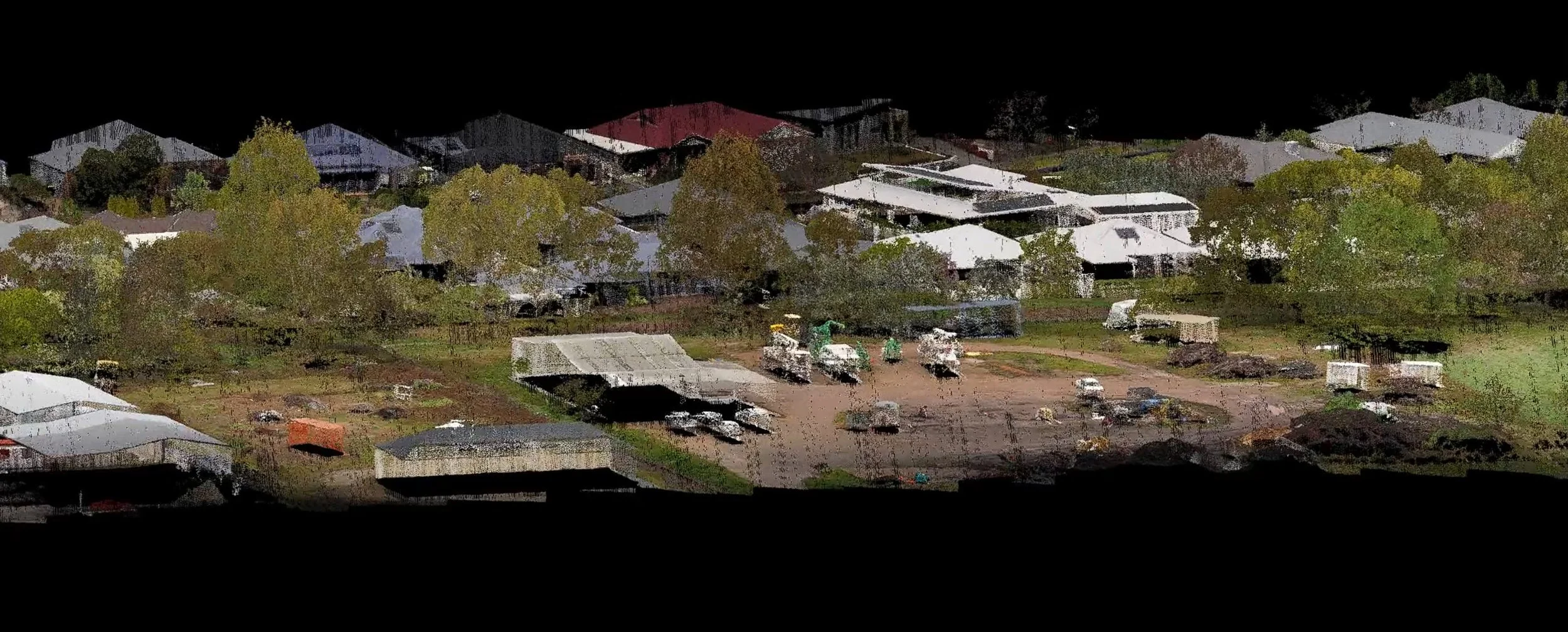
When mounted on a drone, LiDAR sensors can capture millions of measurement points during a single flight. This allows surveyors to produce accurate terrain models, point clouds, and topographic data across large areas far more efficiently than traditional ground-based methods.
Modern aerial drone survey systems can also include:
High-resolution aerial imagery
Multispectral sensors
Environmental monitoring data
Construction and earthworks mapping
Volumetric analysis outputs
Because drones can cover extensive areas quickly while capturing highly detailed information, LiDAR drone surveying has become an increasingly valuable tool across construction, civil infrastructure, mining, agriculture, and environmental management projects.
Why Is UAV-LiDAR Better Than Traditional Surveying Techniques?
Traditional surveying methods still play an important role in many projects, particularly for detailed boundary definition and legal survey work. However, UAV-LiDAR technology offers several major advantages when large areas, difficult terrain, or fast project turnaround times are involved.
By combining aerial efficiency with high-density spatial data capture, drone-based surveys can provide more detailed information in significantly less time while reducing field risks and improving project workflows.
Faster Data Collection
One of the biggest advantages of UAV-LiDAR is speed. Large areas can be surveyed in a fraction of the time compared to traditional ground crews, helping projects move forward sooner.
Higher Accuracy
Modern drone survey systems use advanced GPS and RTK positioning technology to capture highly accurate measurements. This allows surveyors to generate reliable terrain models and topographic data with impressive precision.
Cost-Effective
Drone surveys can reduce labour requirements, field time, and equipment costs across many projects. Faster data collection also helps minimise delays and improve overall project efficiency.
Improved Safety
Traditional surveying can require crews to work in steep, unstable, or hazardous environments. Using drones allows much of the data capture to be completed remotely, reducing exposure to site risks.
Versatility Across Industries
Aerial drone surveying is now widely used across construction, agriculture, mining, environmental management, and infrastructure planning. The technology adapts well to many project types and site conditions.
Real-Time Data Collection
Drone surveys provide fast access to captured data and imagery. This helps project teams make quicker decisions and respond to changing site conditions more efficiently.
Easier Repeat Surveys
Drones make it simple to revisit sites and capture updated information throughout a project lifecycle. This is particularly useful for construction monitoring, earthworks tracking, and ongoing site analysis.
When Should LiDAR Drone Surveying Be Used Instead of Traditional Survey Methods?
While traditional ground surveying remains essential for many applications, there are situations where LiDAR drone technology offers clear advantages. Projects involving large areas, complex terrain, dense vegetation, or urgent delivery timeframes often benefit significantly from UAV-LiDAR solutions.
Since LiDAR can collect highly detailed data quickly and safely, it is often the preferred choice for modern surveying projects that require efficiency, accuracy, and comprehensive site information.
Dense Vegetation and Forested Areas
LiDAR technology can penetrate vegetation canopy and capture ground points beneath trees and dense foliage. This makes it far more effective than many image-based survey methods in heavily vegetated environments.
Large-Scale or Corridor Projects
For highways, pipelines, rail corridors, and major infrastructure projects, aerial LiDAR survey technology can dramatically reduce fieldwork time. Areas that may take weeks using traditional methods can often be completed in days.
Dangerous or Difficult Terrain
Drone surveys are ideal for steep slopes, unstable ground, waterlogged sites, active quarries, and other hazardous environments. Surveyors can safely collect accurate data without physically traversing high-risk areas.
High-Density Topographic Mapping
LiDAR systems capture millions of data points across a site, creating highly detailed terrain models and digital elevation maps. This level of detail is valuable for engineering design, earthworks analysis, and digital twin creation.
Vegetation and Environmental Analysis
LiDAR is widely used in forestry and environmental management because it can accurately map terrain and vegetation structure. This supports biomass calculations, habitat assessment, and broader environmental monitoring projects.
Time-Sensitive Projects
When fast mobilisation and rapid data delivery are critical, UAV-LiDAR offers a major advantage. Drone-based surveys can capture and process large datasets much faster than conventional ground crews.
How Peak Surveyors Delivers Accurate Surveys
Peak Surveyors delivers professional aerial LiDAR survey services and drone-based surveying solutions across Albury, Wodonga, Wangaratta, Bright, and Wagga Wagga.
We integrate drone and LiDAR survey data directly into your broader project deliverables so the outputs are accurate, practical, and ready for immediate use by engineers, planners, architects, and designers.
As one of the country’s top LiDAR surveying companies, we combine advanced drone technology with practical surveying expertise to ensure the data collected supports real project outcomes from planning through to delivery.
If you are planning a project and need fast, accurate, and reliable survey data, contact Peak Surveyors to learn more about our professional drone and LiDAR surveying solutions or request a survey today.