
HomeLiDAR & Aerial Drone Survey.
LiDAR & Aerial Drone Survey.
Precision From Above: LiDAR & Aerial Drone Survey Services
High-accuracy aerial drone survey services and LiDAR drone surveying that deliver detailed spatial data across large sites. Serving Albury-Wodonga, Wangaratta, Bright, Wagga Wagga, and surrounding regions. We provide faster and more accurate surveys than traditional ground methods.
The basics.
What Is a LiDAR and Aerial Drone Survey?
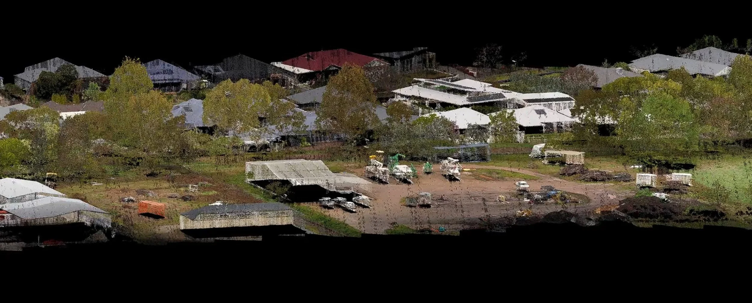
LiDAR (Light Detection and Ranging) is a remote sensing technology that uses pulsed laser light to measure distances and generate precise 3D representations of the earth's surface. When mounted on a drone, LiDAR drone surveying can capture millions of measurement points across large areas in a single flight, producing highly accurate terrain models, point clouds, and spatial data that would take weeks to gather using traditional ground-based methods.
Aerial drone surveys can also incorporate high-resolution cameras and multispectral sensors to capture imagery and data suited to environmental assessment, volumetric analysis, construction monitoring, and topographic mapping.
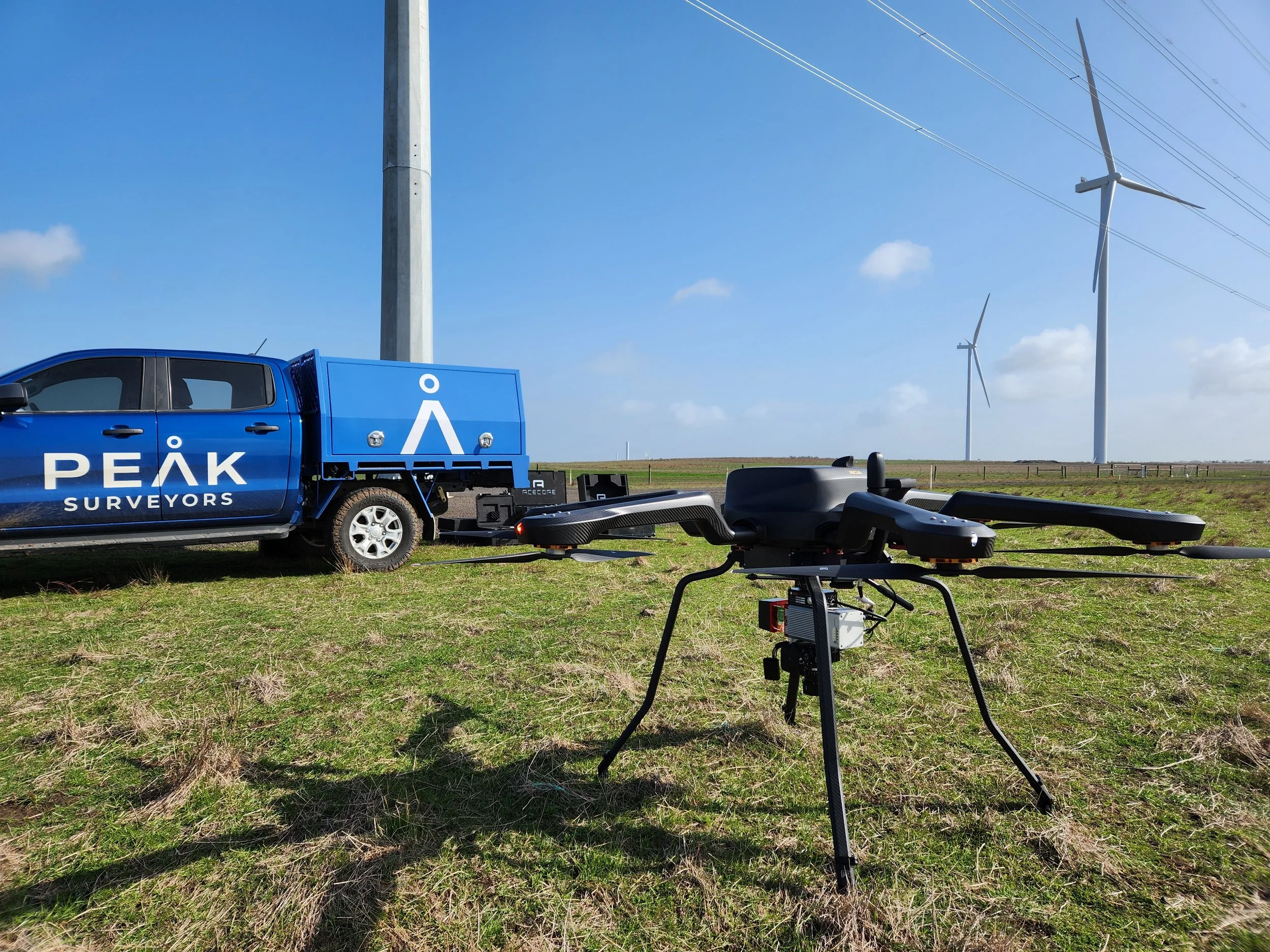
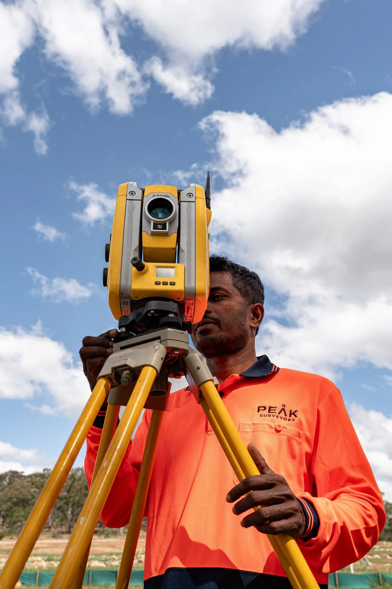
Peak Surveyors offers professional LiDAR drone survey services and aerial drone surveying across Albury, Wodonga, Wangaratta, Bright, and Wagga Wagga. As licensed land surveyors, we integrate drone and LiDAR survey data directly into your broader project deliverables, ensuring the outputs are not just accurate but immediately usable by your engineers, planners, and designers.
What’s included.
Our LiDAR Survey Services and Aerial Drone Survey Services
01LiDAR Point Cloud Data
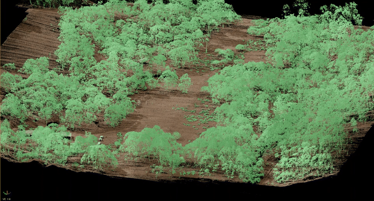
Dense, highly accurate 3D point clouds generated through aerial LiDAR surveys, representing the ground surface, vegetation, and structures across your site. Captured via drone LiDAR surveying, these point clouds form the foundation for terrain modelling, contour generation, volume calculations, and asset mapping, delivered in industry-standard formats ready for use.
02Digital Terrain & Surface Models (DTM/DSM)
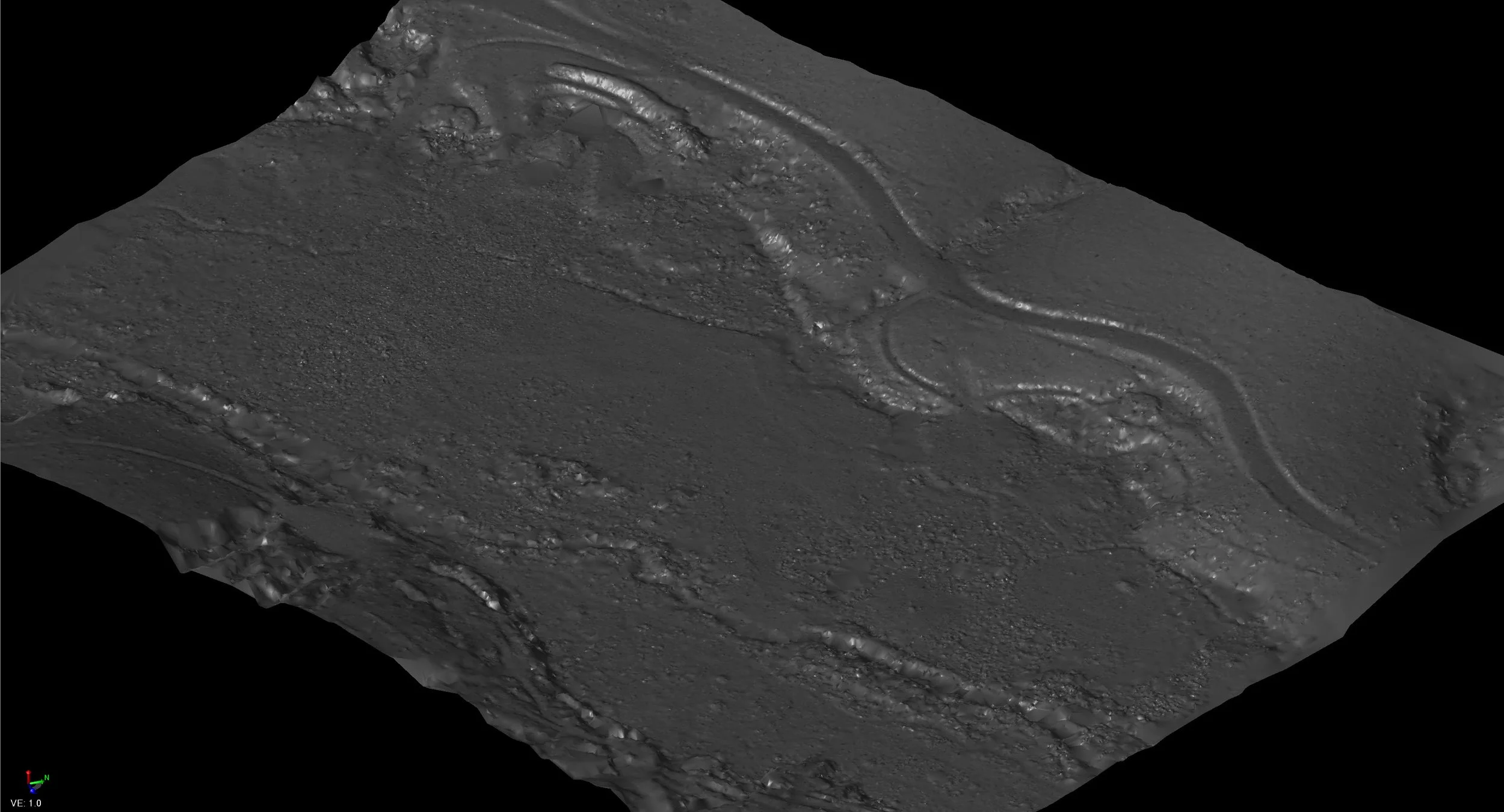
Processed terrain models from aerial LiDAR survey data, separating bare ground from above-ground features like buildings and tree canopy. Essential for flood modelling, earthworks design, infrastructure planning, and civil engineering across regional NSW and Victoria.
03LiDAR Topographic Survey & Contour Mapping
Detailed LiDAR topographic survey outputs and contour maps generated directly from LiDAR land surveying data, delivered in AutoCAD DWG and other standard formats. Our LiDAR topographic surveys are accurate, repeatable, and ready for engineers and designers to use immediately.
04Orthophoto Imagery
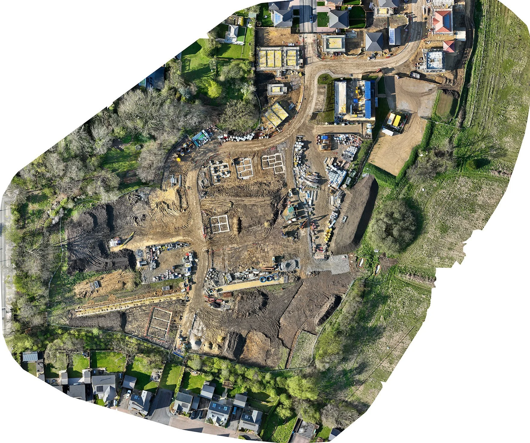
High-resolution aerial imagery, corrected and coordinated spatially to create an accurate base map for design, planning, and reporting. Orthophotos can be layered with LiDAR data to give a complete spatial picture of the site
05Volumetric Analysis
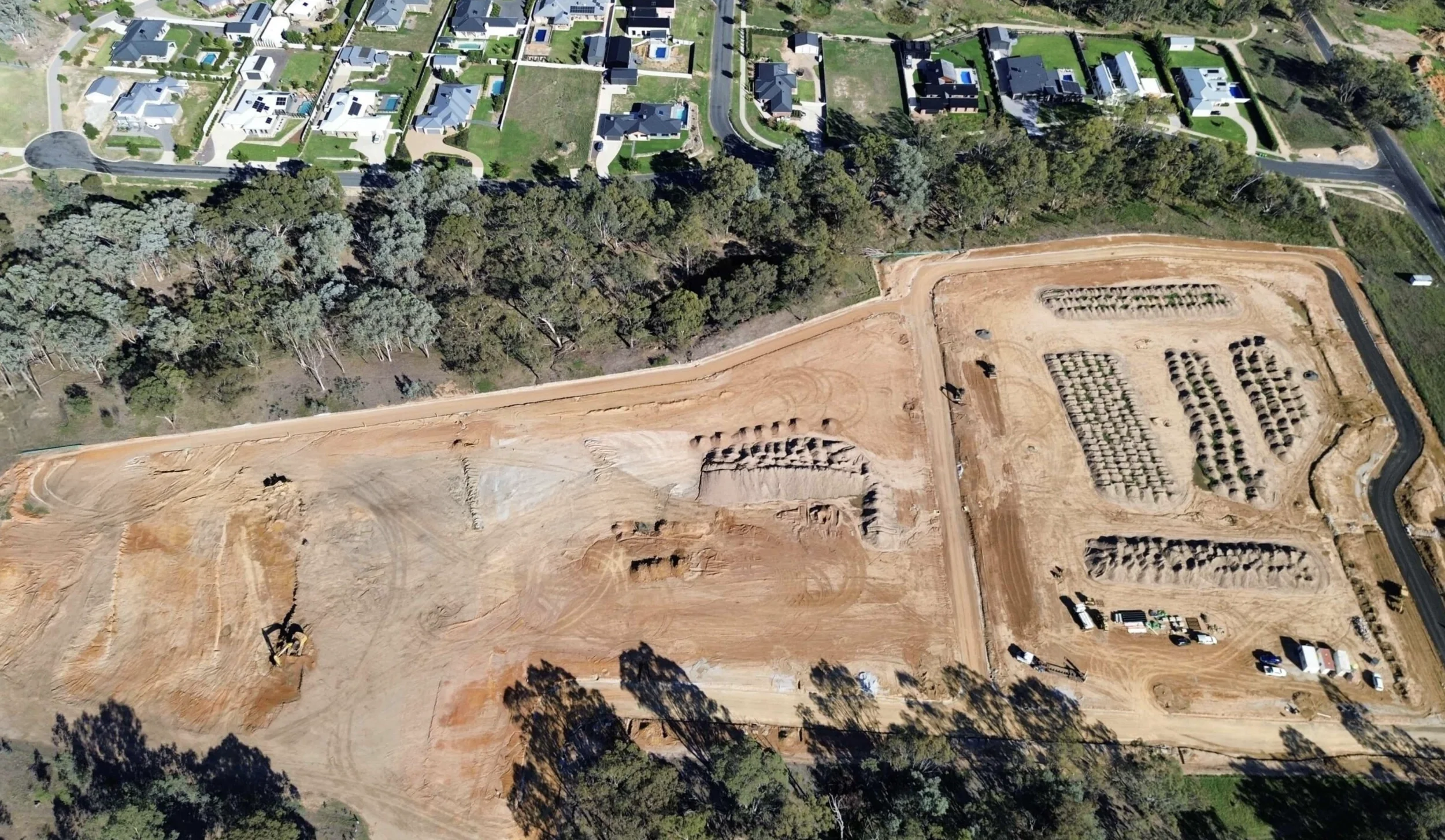
Accurate cut-and-fill and stockpile volume calculations from drone LiDAR data, suitable for mining, civil works, and earthworks management. Results are verified against ground control for maximum reliability and traceability back to survey benchmarks for ongoing volume comparisons over time.
06Environmental & Vegetation Assessment
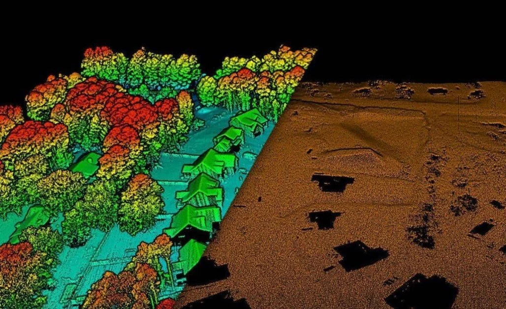
LiDAR penetrates vegetation canopy to reveal ground level beneath, making drone and LiDAR surveys particularly effective for environmental planning, corridor mapping, and biodiversity studies, across landscapes common to Albury, Wangaratta, Bright, and Wagga Wagga.


Our process.
How Our Aerial Drone Survey Process Works
We keep it simple. No jargon, no unnecessary delays. You'll know what's happening at each stage and have a clear picture of when you'll receive your survey.
Project Briefing
We start by understanding your project requirements, site conditions, and the outputs you need, including terrain models, LiDAR topographic surveys, orthophotos, contour maps, or volume reports. Every survey starts with a clear scope, so there are no surprises at delivery.

Flight Planning
We plan the flight path, altitude, and sensor setup to capture data with the accuracy and resolution your project needs. For complex or large sites across areas like Wagga Wagga or the alpine terrain around Bright, this step ensures full, usable coverage, captured in a concise and methodical approach to avoid data gaps.
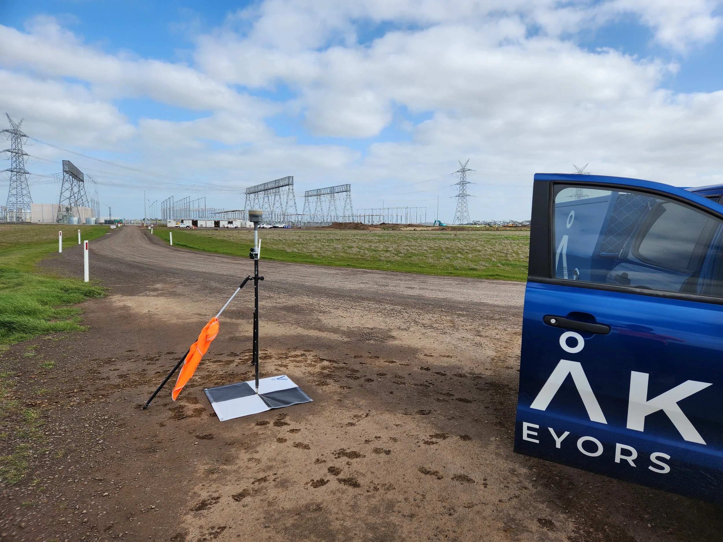
Ground Control
Where required, we set up ground control points across the site to calibrate and verify the accuracy of the LiDAR data against state or international accuracy standards. This step separates professional LiDAR surveys from basic drone operations. Being licensed surveyors gives us a unique and trusted insight to ensure your project is accurate and traceability exists back to industry frameworks.

Aerial Data Capture
Survey data is processed and drafted into a clear, layered AutoCAD plan with features and levels presented to your specification. Every plan is quality-checked before delivery to ensure it meets the requirements of your council or design team.

Data Processing & Quality Check
Raw drone and LiDAR survey data are processed, quality-checked, and refined into the deliverables agreed during the briefing. We don't hand over raw data and leave you to interpret it. We review every output for accuracy before delivery so your team can use it immediately.
Deliverables
Final outputs are delivered in your required format, such as DTM, DSM, orthophoto, CAD contours, or point cloud files. We'll confirm all formats at the briefing stage so your team can work with the data immediately.

Precision. Passion.
Your partner in surveying.

Testimonials.
Kind words from our clients.
Peak Surveyors excel in precision and professionalism. Their top-notch surveying services, from boundaries to topography, are indispensable for any project. With their expertise, your home, business or development ventures are in capable hands. Accurate results and utmost reliability.
Robert Joyce
James and the team did an amazing job at Whitfield Primary School. Not only did they execute a tricky site and assist with developing expertise, they also took the time to teach the kids all about surveying and took pics of them for their use, using their specialised drones also!
Anna Pizini
Very pleased with Peak Surveyors! They were very patient with us and our subdivision. It took us 4 years to get completed due to Covid and other factors. Peak Surveyors kept helping and checking in along the way. Would highly recommend them, very easy going people
Joel Merkel
Questions we hear often about LiDAR & Aerial Drone Survey
If something isn't covered here, call us directly — we're always happy to talk through your project and what's involved.
-
An aerial LiDAR drone survey, also referred to as a drone LiDAR survey, combines an unmanned aerial vehicle (drone) with a LiDAR sensor to capture millions of precise distance measurements across a site in a single flight. The result is a dense 3D point cloud that can be processed into terrain models, topographic maps, contour data, and volumetric calculations. It is faster, safer, and more cost-effective than traditional ground-based survey methods for large or difficult-to-access sites.
Ready to see what drone LiDAR can do for your project? Get a free quote from Peak Surveyors today.
-
Aerial LiDAR surveying typically achieves vertical accuracy of 10–15cm across large areas, which is suitable for most planning, design, environmental, and engineering tasks. Higher accuracy can be achieved with extra ground control points. Peak Surveyors always verifies data accuracy before delivery and we are well placed to use our traditional surveying skills and equipment to obtain higher accuracy survey measurements in site specific areas that are critical for design considerations. This ability to use our traditional land surveying skills and experience with our modern aerial LiDAR techniques gives us a unique advantage to deliver your project to a high standard of accuracy.
-
We provide aerial drone survey services and LiDAR surveying across Albury, Wodonga, Wangaratta, Bright, Wagga Wagga, and the broader regional corridor spanning southern NSW and northeast Victoria. If you're unsure if your site falls within our coverage area, contact us for confirmation.
-
Coverage depends on flight altitude and sensor configuration, but drone-mounted LiDAR can typically survey hundreds of hectares in a single day, far exceeding what ground-based survey methods can achieve in the same timeframe. This makes drone aerial surveying and LiDAR drone survey services particularly cost-effective for large rural, agricultural, infrastructure, and mining sites.
Got a large site? Request a custom quote and find out how quickly we can survey it.
-
Drone operations are weather-dependent. We monitor site conditions closely and will reschedule flights if wind, rain, or visibility would compromise data quality or operational safety. We factor weather contingencies into project planning from the outset, so delays have minimal impact on your overall timeline.
-
Point cloud data is delivered in LAS/LAZ, E57, and RCP formats. Terrain models and contours are available in AutoCAD DWG, GeoTIFF, and other standard industry formats. Deliverable formats are confirmed at the project briefing stage to ensure compatibility with your software and team requirements.
-
Professional LiDAR surveying services use licensed surveyors, calibrated sensors, verified ground control, and quality-assured outputs that meet engineering and regulatory standards. Basic drone imagery usually lacks survey-grade accuracy and structured outputs needed for planning and design.
Get in touch
Tell us about your project
Fill in the form with your project details and we'll come back to you with a clear, fixed quote — typically within one business day.
Areas we serve.
We work across the Albury Wodonga region and surrounding towns on both sides of the Murray River.