
Home3D Scanning & Spatial Solutions.
3D Laser Scanning Survey Services: Millimetre Precision, The world in 3D
3D Scanning & Spatial Solutions.
Professional 3D laser scanning survey services for buildings, structures, and complex environments, delivering accurate point cloud data, as-built documentation, and BIM models you can design and build from. Serving Albury-Wodonga, Wangaratta, Bright, Wagga Wagga, and surrounding regions.
The basics.
What Is a 3D Laser Scanning Survey?
3D laser scanning is a specialist 3D site surveying method that uses high-speed laser technology to capture the exact geometry and spatial data of physical objects and environments, including buildings, structures, industrial facilities, and heritage sites, creating highly accurate digital representations in a fraction of the time required by traditional measurement methods.
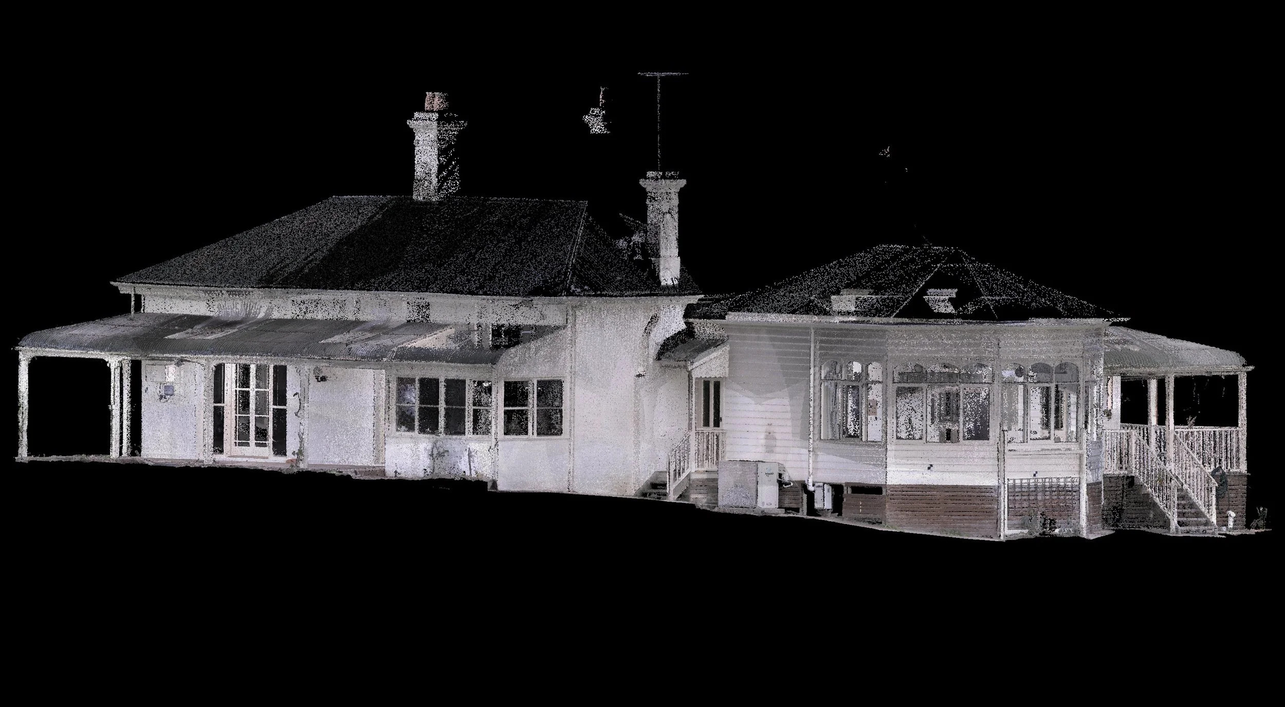
The result is a dense point cloud: millions of precise measurement points that together form a complete 3D record of a space or structure. This data can be processed into as-built drawings, Building Information Models (BIM), digital twins, topographic outputs, and detailed spatial analyses, while maintaining millimetre-level accuracy.
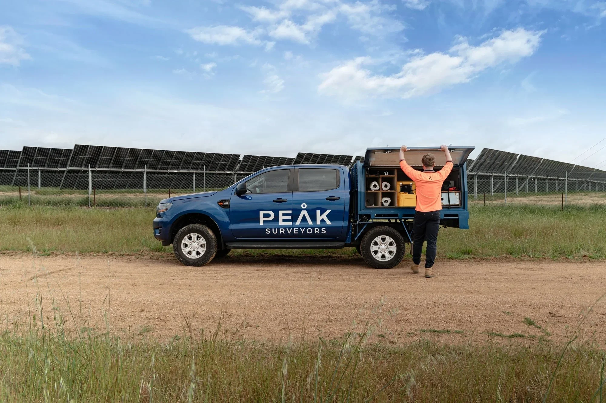
Peak Surveyors provides professional 3D laser scanning survey services across Albury, Wodonga, Wangaratta, Bright, and Wagga Wagga. As licensed land surveyors with expertise in 3D site surveying, we deliver spatial data that is not just accurate, but structured, quality-checked, and ready for immediate use by your architects, engineers, and project teams.
What’s included.
Our 3D Scanning & Spatial Survey Services
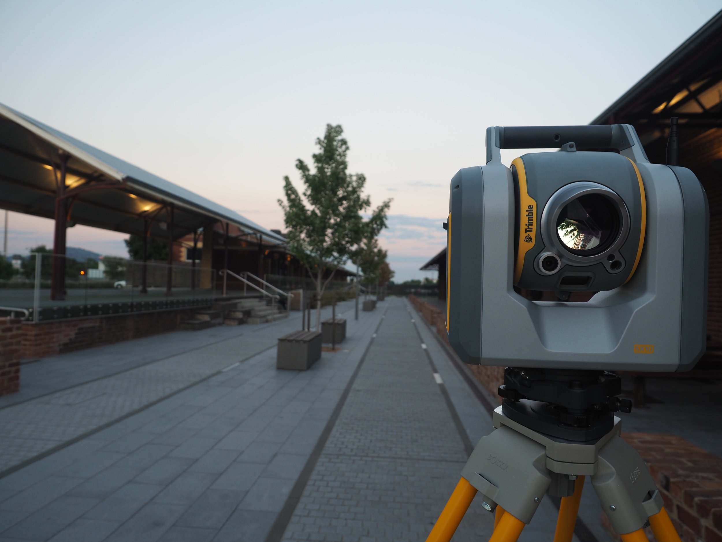
013D Laser Scanning
High-density point cloud capture of buildings, structures, and environments using terrestrial 3D laser scanning survey equipment. Our 3D laser scanning survey service covers interior and exterior spaces of any size or complexity, from single-room fitouts to large-scale industrial facilities and multi-storey buildings.
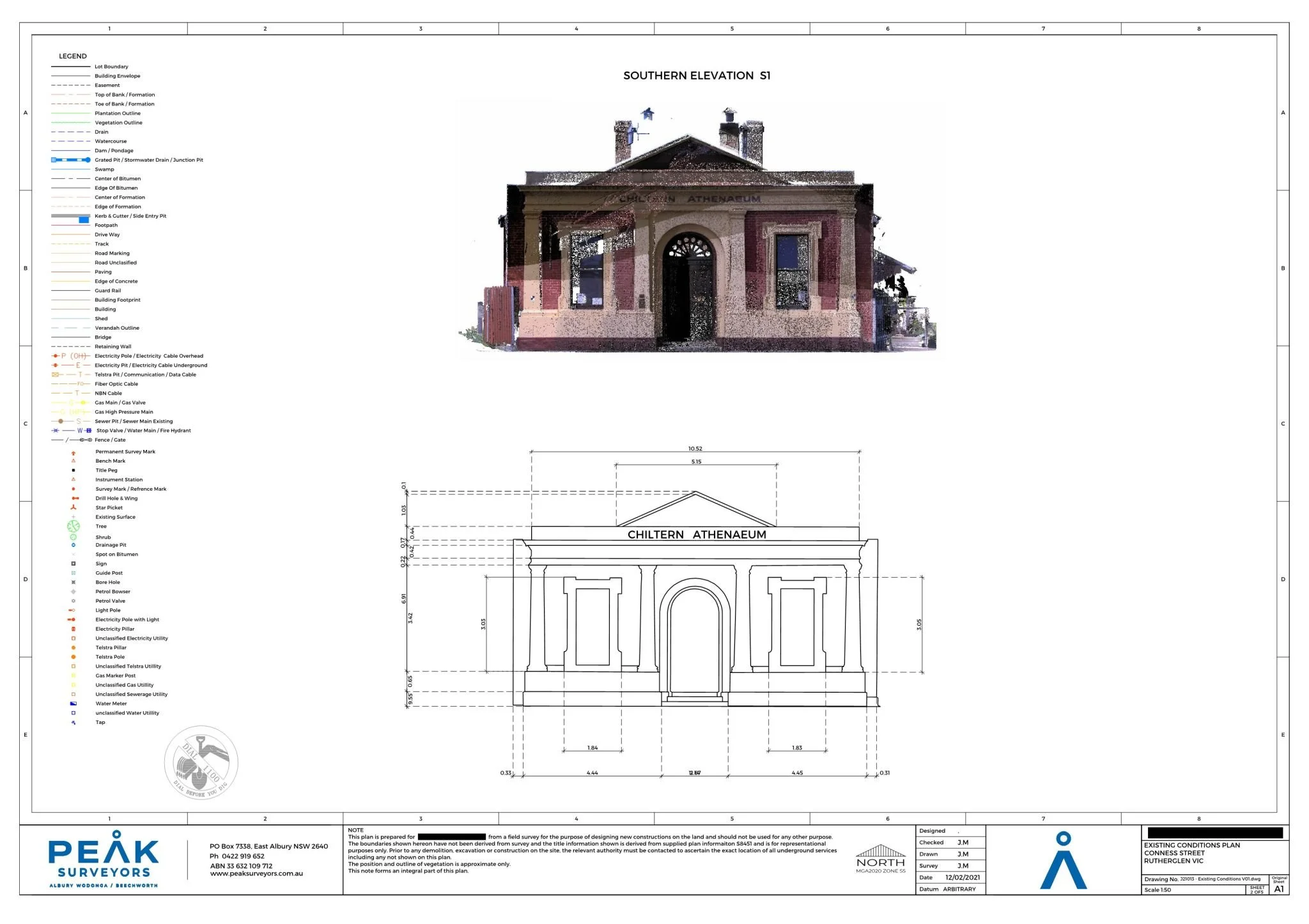
02As-Built Documentation
Accurate digital records of existing structures derived from 3D scan data, including floor plans, elevations, sections, and full 3D models. Ideal for renovation and refurbishment projects, compliance verification, insurance documentation, and future works planning.
03BIM Model Production
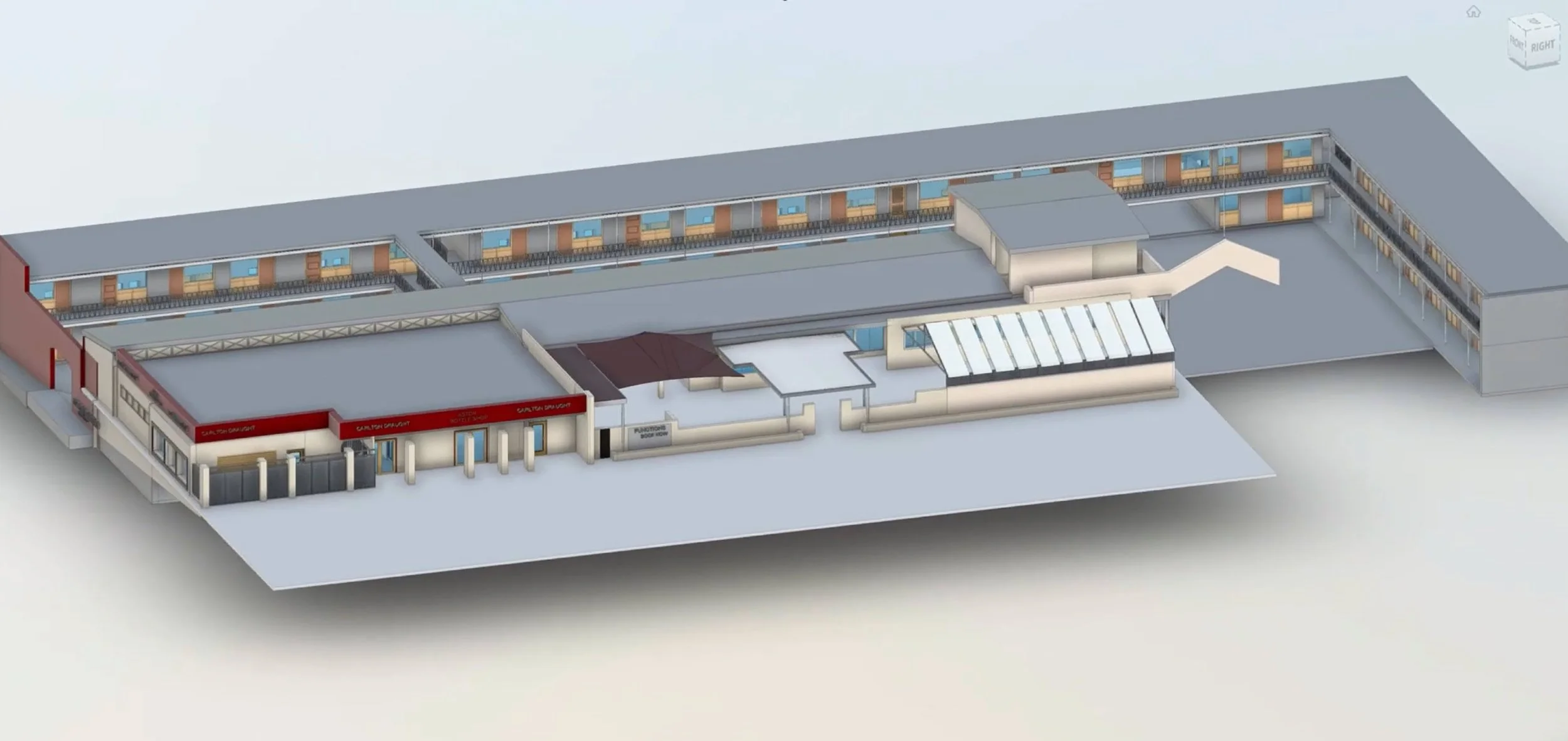
Scan data processed into Building Information Models (BIM) compatible with Revit, AutoCAD, Navisworks, and other leading platforms. Our 3D laser scanning land surveying outputs are structured for direct handover to architects, engineers, and project managers, saving time and reducing coordination risk on complex projects.
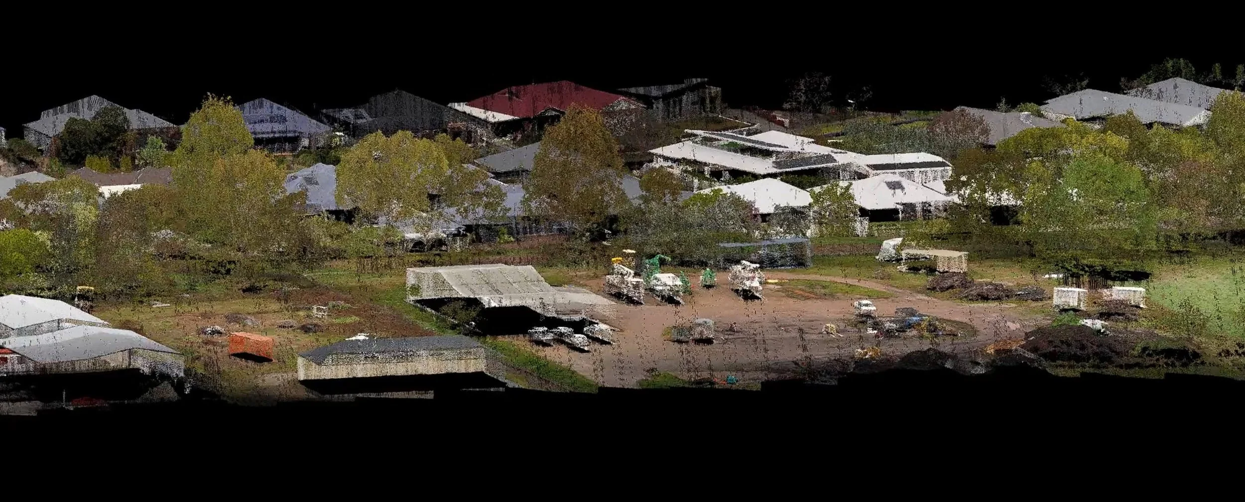
043D Laser Scanning Topographic Surveys
Where terrain context is required alongside structural data, we integrate 3D laser scanning topographic surveys with terrestrial survey methods to deliver a complete spatial picture of the site. Particularly valuable for civil, infrastructure, and development projects across the varied landscapes.
05Heritage Recording
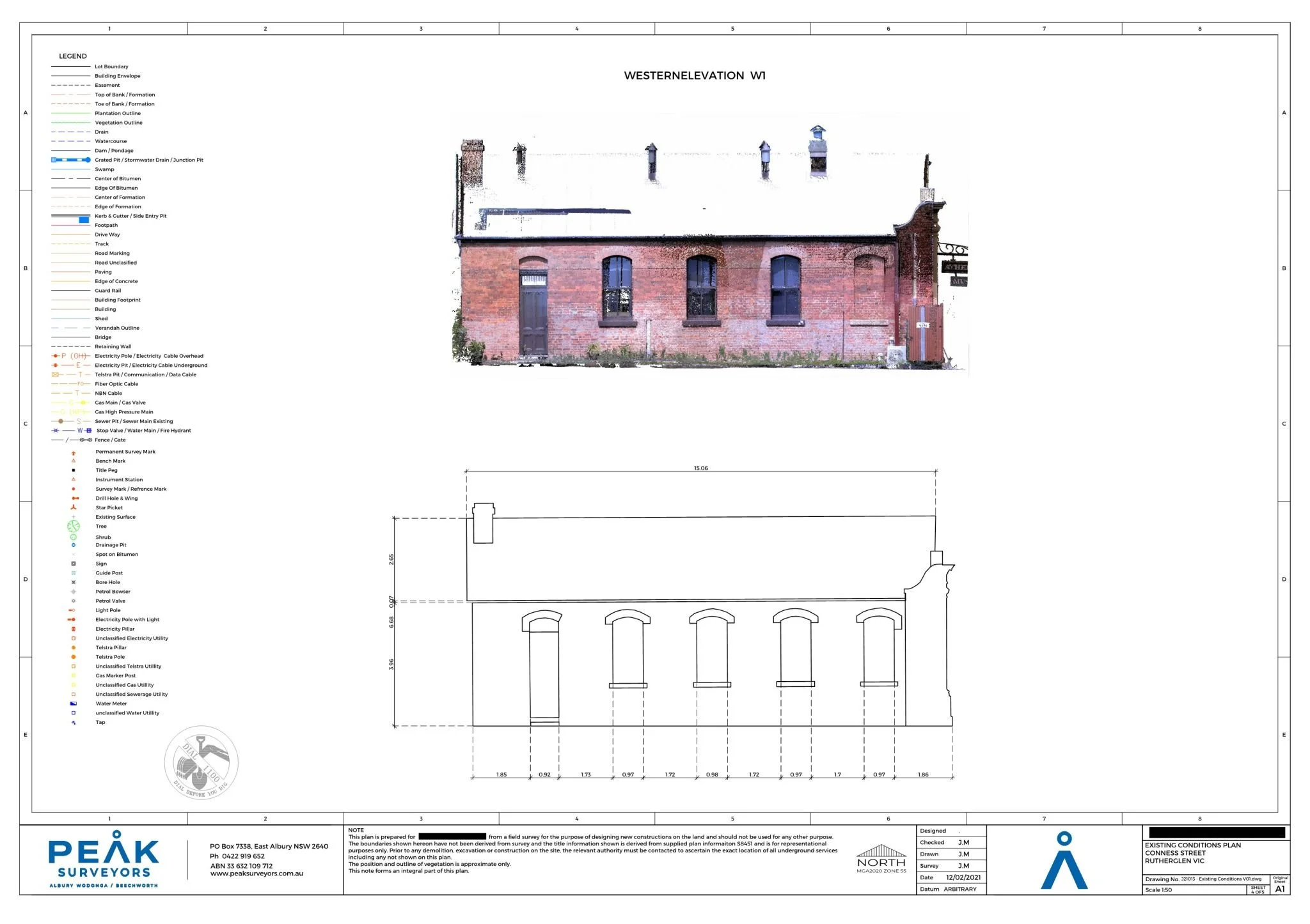
Detailed 3D documentation of heritage buildings and structures for conservation, restoration, and archival purposes. 3D scanning captures fine architectural detail and difficult-to-access features that traditional measurement methods cannot safely or accurately reach, producing a permanent, precise digital record for future reference.
06Structural & Deformation Monitoring

Repeat 3D scanning of structures over time to detect movement, settlement, or deformation. Supporting structural assessment, maintenance planning, and long-term asset management, particularly for ageing infrastructure and buildings in areas subject to subsidence or environmental loading.
07Point Cloud Deliverables
Survey data delivered in AutoCAD DWG format with clearly labelled layers, ready for use by architects, civil engineers, and planners in all major design platforms. PDF plans and other formats are available on request.

Our process.
How Our Feature and Level Survey Process Works
We keep it simple. No jargon, no unnecessary delays. You'll know what's happening at each stage and have a clear picture of when you'll receive your survey.
Project Scoping
We begin by understanding your project, including the structure or environment to be scanned, the level of detail required, and the deliverables you need, such as as-built drawings, a BIM model, a topographic output, or raw point cloud files.
Site Preparation
We confirm access requirements, identify optimal scanner positions, and establish reference targets where needed to ensure accurate data registration across the full scan area. Thorough site preparation is what ensures clean, complete data, and avoids costly rescan visits.

3D Scanning
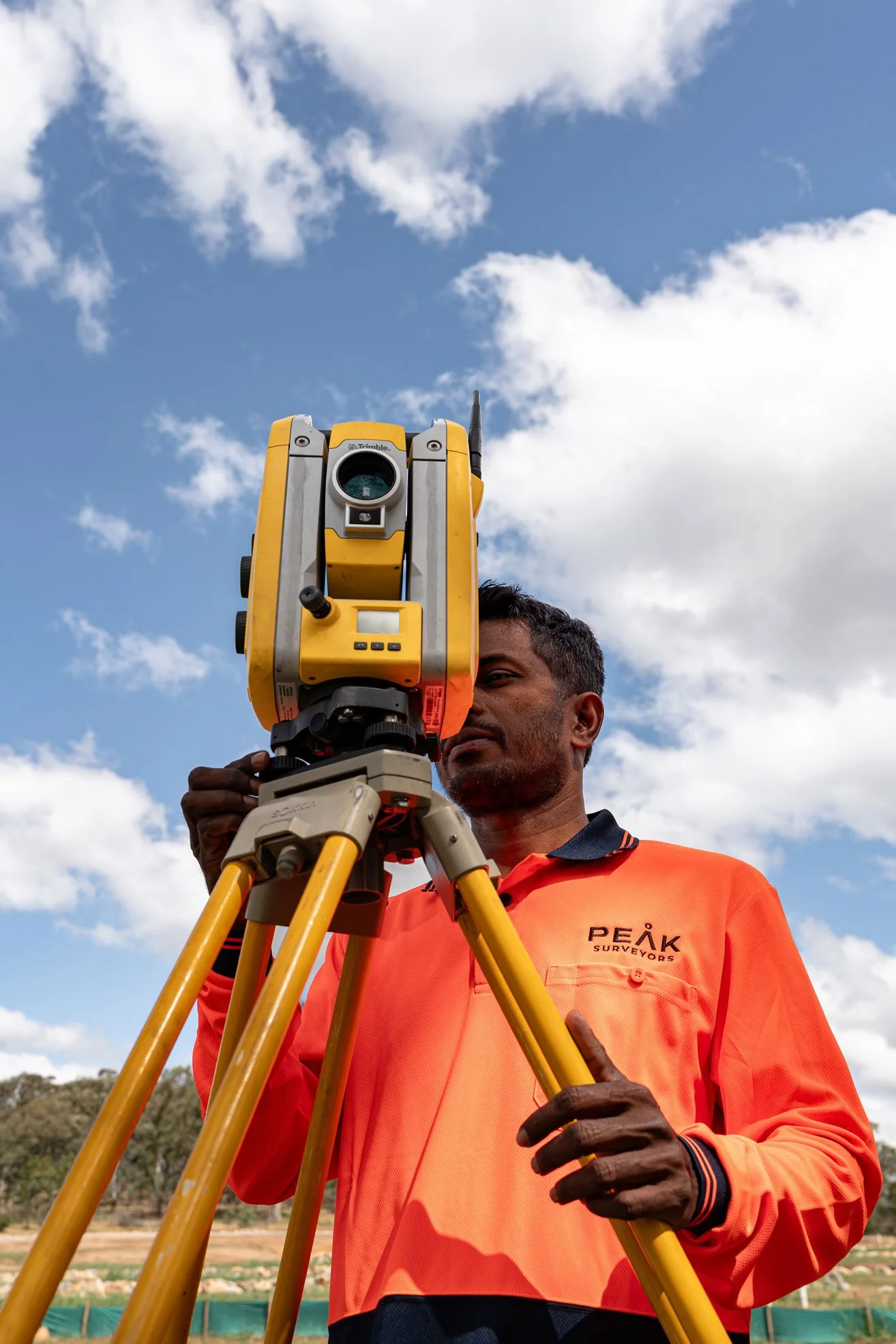
Our team systematically scans the site from multiple positions, ensuring complete coverage with sufficient overlap between scans for precise registration. All scanning is conducted by licensed and experienced surveyors and qualified spatial data professionals using calibrated, survey-grade laser scanning equipment.

Data Registration & Processing
Individual scans are aligned and merged into a single, unified point cloud. Data is cleaned, quality-checked, and processed into the agreed deliverable format. Every 3D scan survey dataset we deliver has been reviewed for accuracy, completeness, and usability before it reaches your team.
Deliverables & Review
Final outputs such as point clouds, CAD drawings, BIM models, topographic data, or reports, are delivered in your required format. We walk your team through the data to ensure it meets your expectations and integrates smoothly with your project workflow.

Precision. Passion.
Your partner in surveying.

Testimonials.
Kind words from our clients.
Peak Surveyors excel in precision and professionalism. Their top-notch surveying services, from boundaries to topography, are indispensable for any project. With their expertise, your home, business or development ventures are in capable hands. Accurate results and utmost reliability.
Robert Joyce
James and the team did an amazing job at Whitfield Primary School. Not only did they execute a tricky site and assist with developing expertise, they also took the time to teach the kids all about surveying and took pics of them for their use, using their specialised drones also!
Anna Pizini
Very pleased with Peak Surveyors! They were very patient with us and our subdivision. It took us 4 years to get completed due to Covid and other factors. Peak Surveyors kept helping and checking in along the way. Would highly recommend them, very easy going people
Joel Merkel
Questions we hear often about 3D Scanning & Spatial Solutions
If something isn't covered here, call us directly — we're always happy to talk through your project and what's involved.
-
A 3D laser scanning survey, also known as a 3D scan site survey, uses a high-speed laser scanner to capture millions of precise measurement points across a structure or environment, producing a detailed point cloud. This data is used to create as-built drawings, BIM models, topographic maps, heritage records, and structural monitoring reports, or wherever accurate spatial information about an existing building or site is required.
-
Terrestrial 3D laser scanning is used to capture detailed geometry of structures, interiors, and environments at close range, typically within a building or around a specific structure. LiDAR is most commonly used for large-area aerial surveys of terrain and landscape. Both technologies produce point clouds, but they operate at different scales and serve different project types. Peak Surveyors offers both services and can advise which is appropriate for your project, or combine the two to give your project the accuracy it needs, where it needs it, and the scale of data capture.
-
Yes. Terrestrial 3D scanning is particularly well suited to interior environments, including complex multi-storey buildings, industrial facilities, heritage structures, and confined or difficult-to-access spaces. The scanner captures the full geometry of a room or structure without the need for physical contact or manual measurement.
-
Terrestrial laser scanning typically achieves millimetre-level accuracy, making it suitable for structural assessment, heritage documentation, as-built verification, and BIM production where high precision is critical. Peak Surveyors uses calibrated, survey-grade equipment and verifies all data before delivery.
-
Peak Surveyors provides 3D laser scanning survey services across Albury, Wodonga, Wangaratta, Bright, Wagga Wagga, and the broader regional corridor across southern NSW and northeast Victoria. Contact us to discuss your site location and project requirements.
-
We deliver point cloud data in E57, RCP, and LAS/LAZ formats. BIM outputs are produced in Revit, and CAD drawings in AutoCAD DWG. We can accommodate custom output requirements depending on your software environment. We confirm your needs at the project scoping stage and ensure full compatibility.
-
Professional 3D surveying services, as provided by Peak Surveyors as licensed land surveyors, combines survey-grade scanning equipment with spatial data expertise, quality assurance processes, and integration with the broader surveying and design workflow. The result is data that meets engineering, planning, and regulatory standards, rather than general-purpose 3D scanning that may lack the consistency or coordination against a larger project outcome context. As licensed land surveyors, we can select the skills and equipment to use for your specific project objectives. We can mix and match to get you the best outcome.
Get in touch
Tell us about your project
Fill in the form with your project details and we'll come back to you with a clear, fixed quote — typically within one business day.
Areas we serve.
We work across the Albury Wodonga region and surrounding towns on both sides of the Murray River.